During a field excursion in the Las Minas watershed, as well as a weather station in Punta Arenas, we investigated how unusual rain events, harsh winds, and landslides converge to create significant flooding problems for the city. While Punta Arenas typically sees only moderate rainfall, abrupt, high-volume storms can have outsized impacts when they combine with landslides. Recent data from the Jorge Schythe weather station shows that extreme precipitation events, although relatively infrequent, do occur and have triggered rapid changes in the local landscape. We largely focused on the large flooding event in 2012.
In the Las Minas watershed above Punta Arenas, soft or unstable geological formations are prone to collapsing under excess water from extreme rainfall. Whenever rain saturates the soil and rock layers, large portions of land can slope down and fall. These landslides can block off the main river, creating a temporary natural dam that traps water.
On March 12, 2012, Punta Arenas experienced a historic flood, partly driven by heavy rains (over 25 percent of the average annual precipitation fell in just two days!!). Meanwhile, the Las Minas watershed upstream was also being hit by intense precipitation, which fueled landslides that formed a barrier on the river. Because Punta Arenas is downstream, a huge amount of water was quietly building up behind the landslide dam before Punta Arenas. Once that barrier gave way, the water went to the city, causing widespread damage.
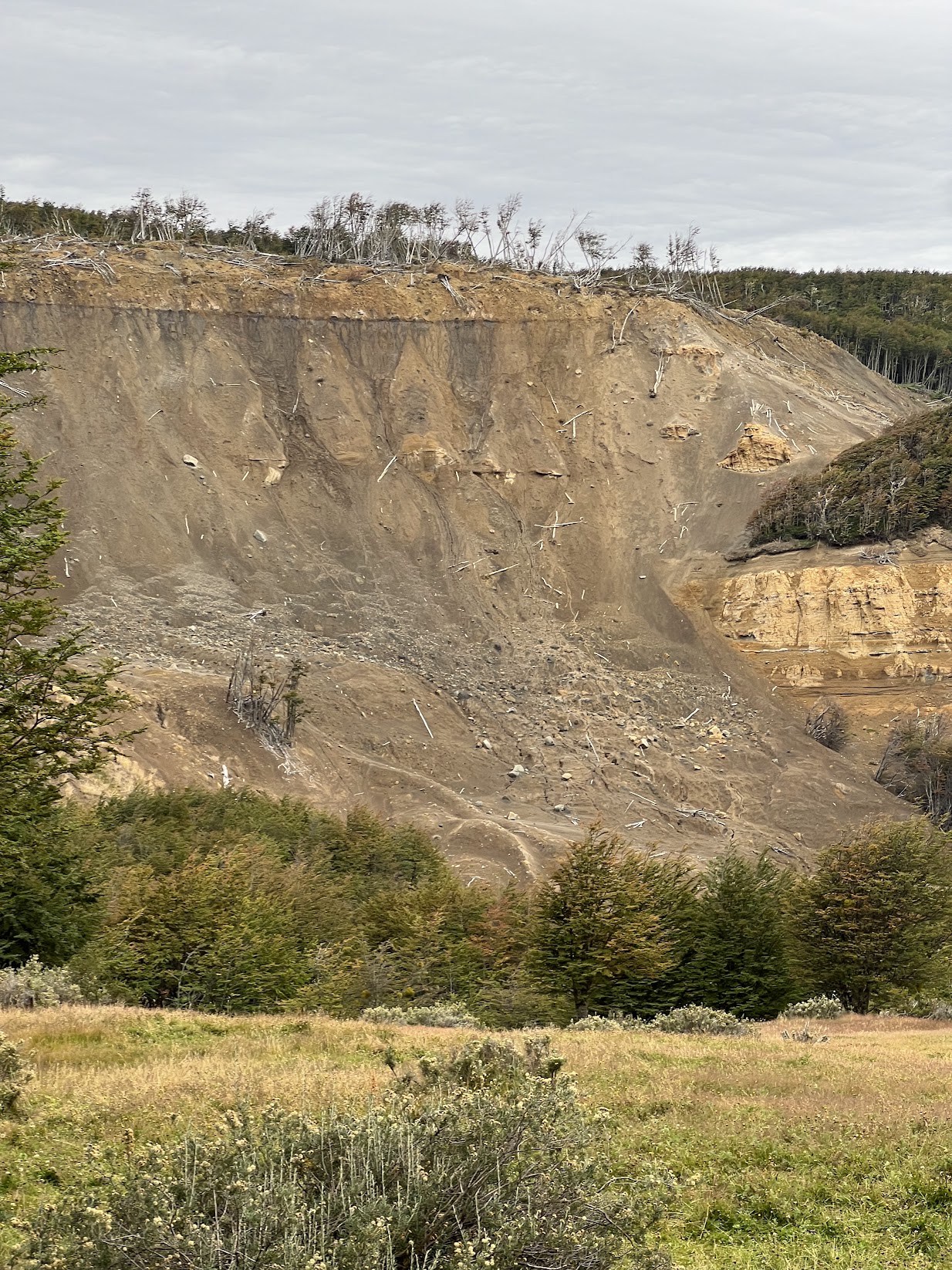
On our field expedition, we visited some landslides, all rotational, meaning they slid down a concave surface, creating a visibly concave slid area. We focused largely on two large landslides: The first occured in the 1970s, and shows clear evidence of regrowth on the slid soil itself. The second one we visited was the landslide that actually caused the dam buildup in 2012.
During our field expedition, we visited several landslides, all characterized as rotational landslides. Rotational landslides involve movement of soil along a concave surface. This results in distinctively concave-shaped scarps displacement that rotated backward, giving the landscape a stepped/sloped appearance.
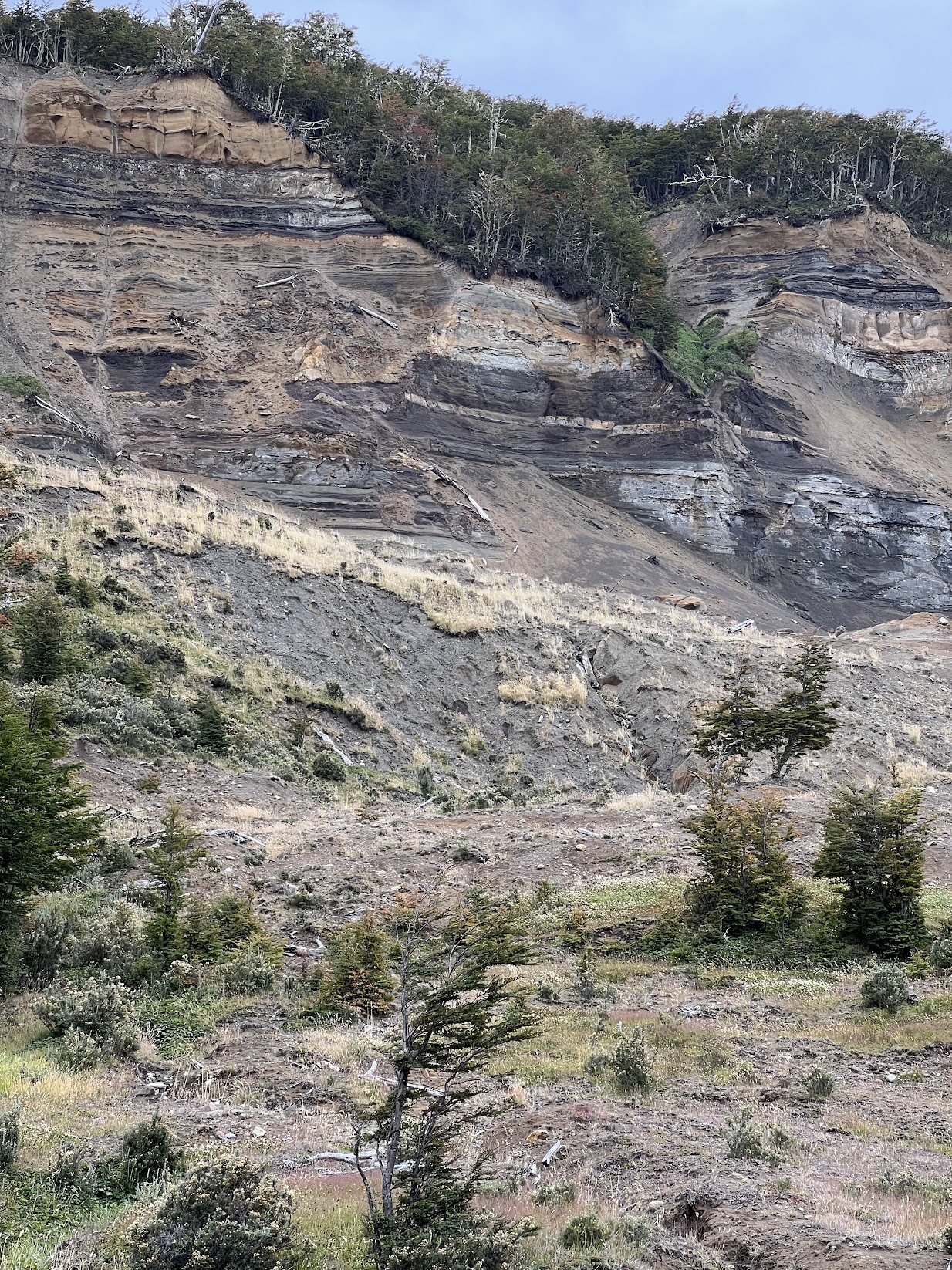
The first landslide occurred in the 1970s and provided clear evidence of ecological succession, demonstrating substantial growth on the slid soil itself. The second landslide we examined was much more recent in 2012 (the one that caused the dam). Unlike the older landslide, this one showed limited growth, with exposed soil and fragmented rock materials still very visible.
Now, the other aspect of the field expedition was to evaluate the extreme weather event itself, and how weather data is collected. We visited the Jorge Schythe automatic weather station in Punta Arenas, and got to observe the different monitoring equipment they have. The monitors capture precipitation, wind speed, snow depth, albedo, temperature, and more. For our field writeup, we utilized solely this information for our analysis!
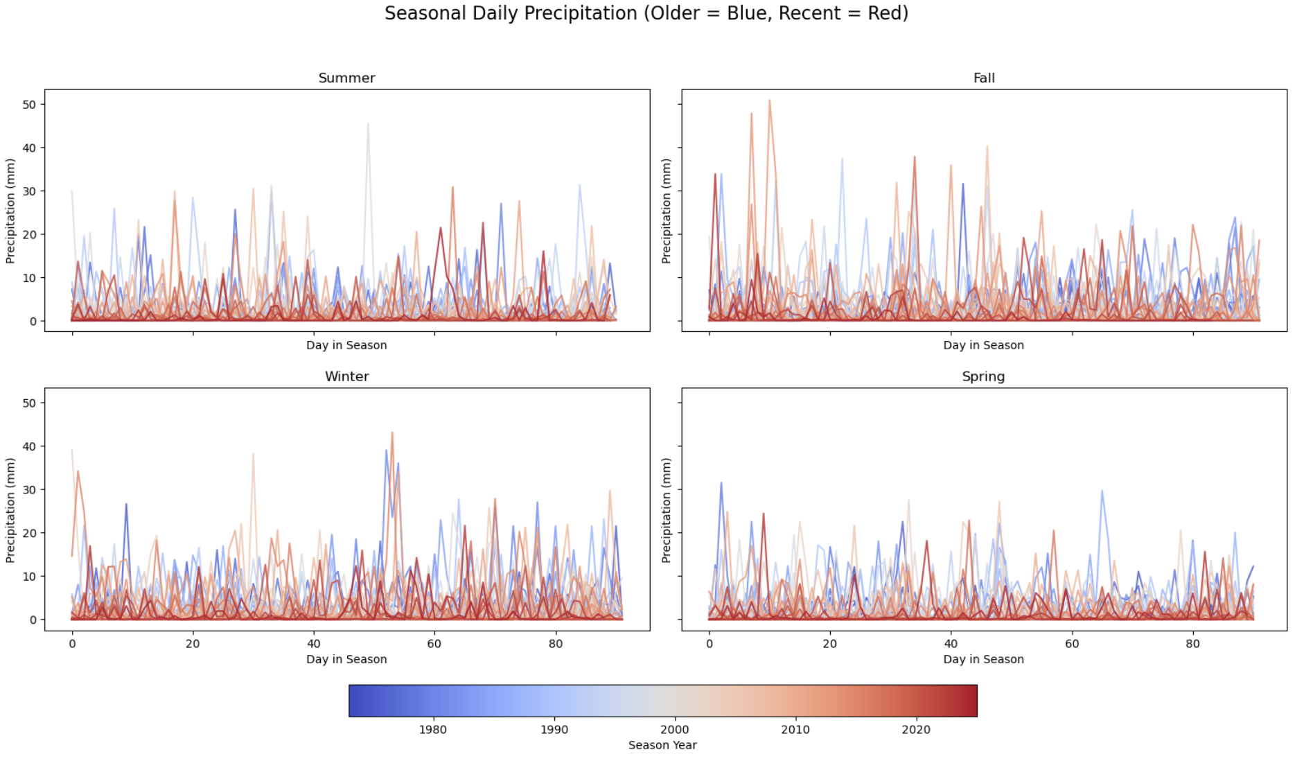
We approached our analysis of extreme precipitation in Punta Arenas by applying Extreme Value Theory (EVT), specifically the Generalized Extreme Value (GEV) distribution. In practical terms, this means zooming in on the single highest daily rainfall measurement for each season and seeing how well it fit the curve. Doing so helped us judge the likelihood that rainfall in this area might have “heavy tails,” or in other words, a higher chance of truly massive rainstorms than standard precipitation models tend to predict. All seasons showed a positive shape parameter (ξ>0), suggesting that rare but extremely intense storms are very much on the table.
When we looked at overall findings, it became clear that while annual rainfall in Punta Arenas remains moderate, the region is vulnerable to short, powerful downpours. This vulnerability is made worse by the unstable geology in the Las Minas watershed, which is clearly prone to landslides. In short, these results point to the importance of carefully monitoring rainfall patterns.